RWS4000

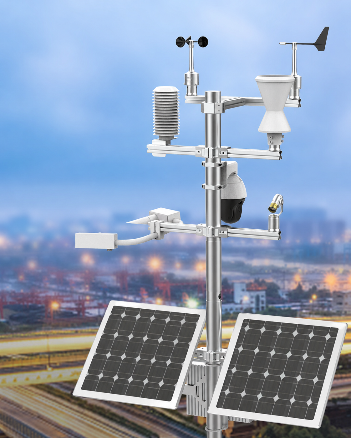
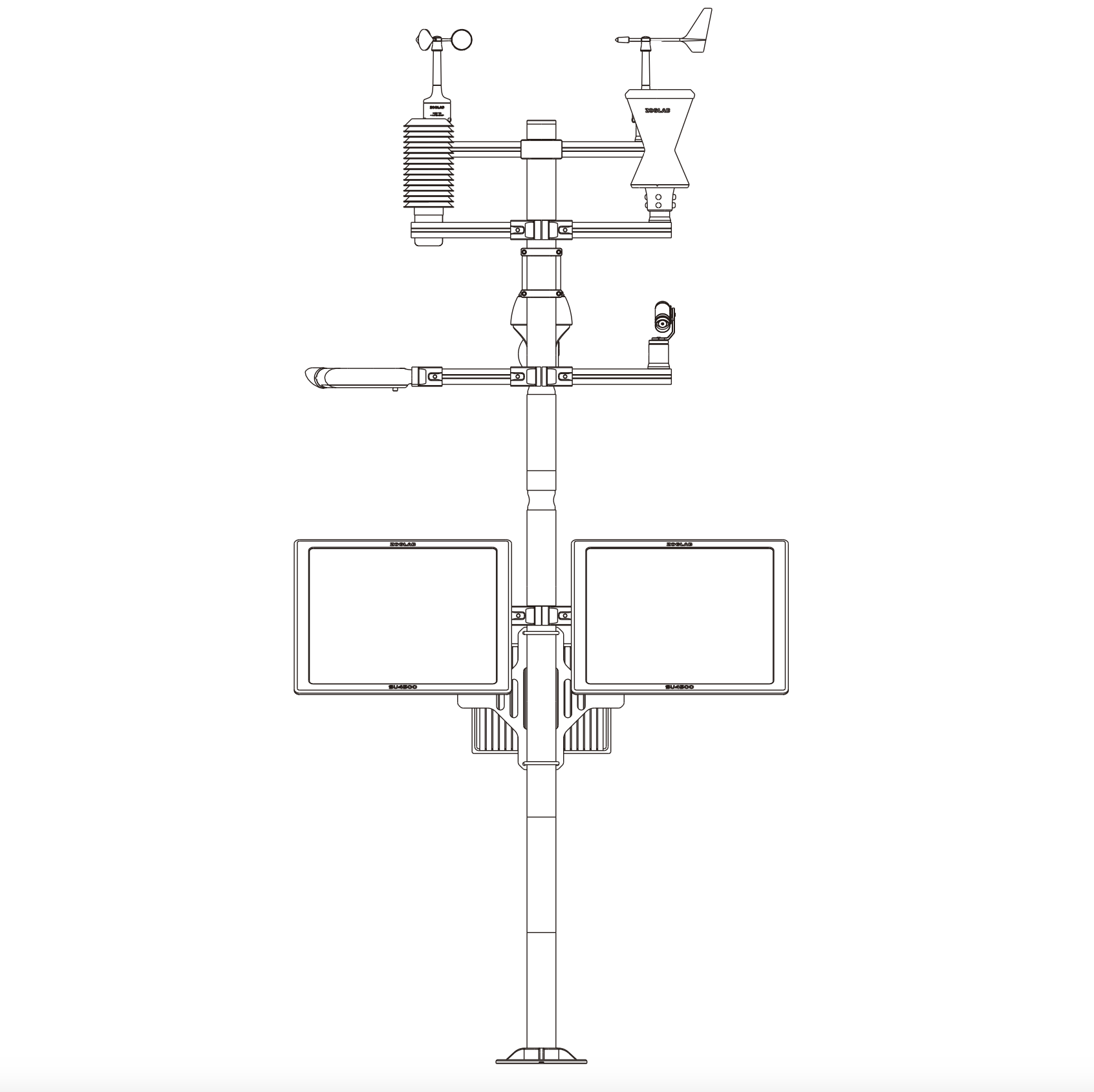
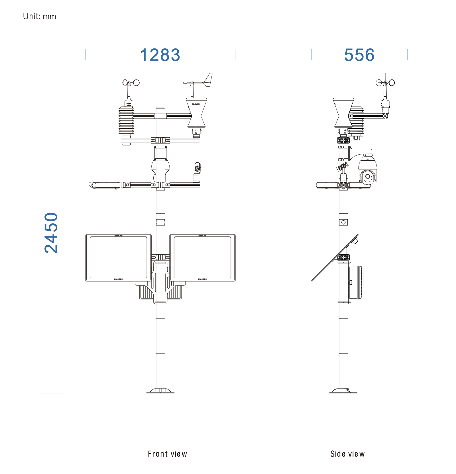
Eight-parameter Road Weather Station

A professional eight-parameter automatic weather station integrating temperature, humidity, wind speed, wind direction, air pressure, rainfall, visibility and pavement thickness measurement. A pole-mounted station built for transport infrastructure as road, bridge and ITS deployments — combines atmospheric sensors with mounting for OWS road-surface sensors and integrates with traffic management systems.

ITS-readySolar + 4GVisibility + pavement4G / WiFi / Ethernet

The RWS4000 is a professional eight-parameter automatic weather station that bundles core meteorology — temperature, humidity, wind, air pressure, rainfall — with visibility and infrared road-surface temperature into a single solar-autonomous mast. An optional real-time video terminal completes the picture for traffic, bridge and ITS deployments.

Various communication interfaces enable a remote wireless link between the station and the monitoring centre over WiFi, GPRS, 4G or LoRa; an optional large wireless LED screen can publish current pavement and atmospheric conditions on site. Open protocols let the platform feed straight into national meteorological networks and dynamic message-sign systems.

Specification

Technical parameters

Temperature
Measuring range
−30°C ~ 70°C; −40°C ~ 60°C; −50°C ~ 50°C
Measuring accuracy
±0.1°C (23°C ±2°C); −40°C ~ 60°C ±0.2°C
Resolution
0.01°C / 0.02 °F
Humidity
Measuring range
0% ~ 100% RH
Measuring accuracy
±2.5%RH (10%~85%); other ranges ±5.0%RH (measurement environment 23°C ±2°C)
Resolution
0.01%RH
Air pressure
Measuring range
500 ~ 1100 hPa
Measuring accuracy
±0.10hPa (−10~50°C); ±0.20hPa (−40~50°C)
Resolution
0.01 hPa
Stability
≤ 0.2 hPa/year
Wind speed
Measuring range
0.5 ~ 65 m/s
Start wind speed
< 0.5 m/s
Conversion characteristic
U = 0.1×R + 0.32 (U = wind speed [m/s], R = output pulse frequency [Hz])
Maximum allowable error
±0.5 m/s
Wind direction
Measuring range
0° ~ 360° (wind speed 0.5~65 m/s)
Start wind speed
< 0.5 m/s
Maximum allowable error
Better than ±2° (RS485); better than ±3° (7-bit Gray code); better than ±2° (0–5 V analog)
Resolution
±0.5° (RS485); ±3° (7-bit Gray code); ±1° (0–5 V analog)
Rainfall
Water bearing diameter
200 cm² (φ159.60 ± 0.6 mm)
Resolution
0.1 mm
Rain intensity range
0 ~ 4 mm/min
Maximum allowable error
±0.4 mm (≤10 mm); ±4% (>10 mm)
Visibility
Measuring range
10 m ~ 10000 m
Measuring accuracy
±10% (<1500 m); ±20% (>1500 m)
Infrared road surface
Temperature range
−40°C ~ 70°C (maximum range −70 ~ 380°C)
Measuring accuracy
±0.2°C (−10°C ~ 65°C); ±0.5°C (−40°C ~ 70°C)
Resolution
0.02°C
Measurement uncertainty
±0.1°C, repeatability ±0.05°C (−10°C ~ 65°C); ±0.3°C, repeatability ±0.05°C (−40°C ~ 70°C)
Pavement response time
< 1 s
Channel wavelength range
8 ~ 14 µm
Measuring angle
22°
System & interfaces
Sensors included
Temp / Humidity / Wind / Rain / Visibility
Power
Solar + 4G with mains failover
Communication
4G, LoRa, RS485
Mounting
Pole, gantry or bridge mast
Operating temperature
−40°C ~ 70°C
Protection
IP66
Compatible sensors
ITS1000, HY-RSS11E, HY-RSS12E, HY-IRS2E
Communication interface
RS232, RS485, USB Type-C virtual serial port, Ethernet, WiFi, BLE, 4G / LoRa
GNSS positioning and timing
BDS / GPS / GLONASS / GALILEO / QZSS / SBAS
Solar panel power
45 W × 2
Battery
Lithium battery, capacity 30000 mAh × 3, 12 V
Operating hours
Continuous rainy days ≥ 15 (with camera function turned on regularly)
Storage environment
−40°C ~ 60°C, 0%~100%RH
Operating environment
−40°C ~ 60°C, 0%~100%RH
Protection level
IP65
Dimensions
2740 × 1280 × 824 mm
Weight
About 70 kg
More from this family

Pairs well with

See all road models →